

Abstract
Scenarios of future changes in small scale precipitation extremes for the Netherlands are presented. These scenarios are based on a new approach whereby changes in precipitation extremes are set proportional to the change in water vapor amount near the surface as measured by the 2m dew point temperature. This simple scaling framework allows the integration of information derived from: (i) observations, (ii) a new unprecedentedly large 16 member ensemble of simulations with the regional climate model RACMO2 driven by EC-Earth, and (iii) short term integrations with a non-hydrostatic model Harmonie. Scaling constants are based on subjective weighting (expert judgement) of the three different information sources taking also into account previously published work. In all scenarios local precipitation extremes increase with warming, yet with broad uncertainty ranges expressing incomplete knowledge of how convective clouds and the atmospheric mesoscale circulation will react to climate change.
Export citation and abstract BibTeX RIS

Content from this work may be used under the terms of the Creative Commons Attribution 3.0 licence. Any further distribution of this work must maintain attribution to the author(s) and the title of the work, journal citation and DOI.
1. Introduction
It is generally anticipated that precipitation extremes will increase with global warming—a statement which was assigned high confidence in the latest IPCC report (IPCC 2013). There is medium confidence that this increase is 5–10% per degree of warming, dependent on location, season and time scale of the precipitation event (see e.g. chapters 7.6.5 and 12.4.5.5 in the IPCC report). Widespread model support exists for increases in precipitation extremes and intensification of the hydrological cycle from global and regional climate models (Emori and Brown 2005, Fowler et al 2007, Giorgi et al 2011, Kharin et al 2013, Wuebbles et al 2014).
The straightforward theory behind the intensification of rain is that as the climate warms more moisture will be available to a rainstorm, and this will cause more extreme precipitation (Trenberth et al 2003). In the absence of substantial changes in relative humidity, the moisture content of the air will rise by 6–7% per degree following the Clausius–Clapeyron (hereafter CC) relation. It has been argued that changes in precipitation extremes are closely tied to the CC relation (Allen and Ingram 2002, Pall et al 2006). However, other research has shown that they do not necessarily follow the CC relation exactly. In particular, changes in the large and small scale dynamics of the atmosphere and its vertical stability are likely to cause deviations from CC scaling (Emori and Brown 2005, O'Gorman and Schneider 2009, Sugiyama et al 2010, Allan 2011, Singleton and Toumi 2013).
Recent evidence from observations reveals that changes in sub-daily precipitation intensity, as measured for instance by hourly precipitation, could increase in excess of the CC relation—a behavior we refer to as super CC scaling (Westra et al 2014). For instance, for the Netherlands (NL) an increase of approximately two times the CC relation in hourly precipitation has been found (Lenderink and van Meijgaard 2008, Lenderink et al 2011). Other work supports super CC scaling for at least a limited temperature range (Westra and Sisson 2011, Mishra et al 2012, Berg et al 2013, Panthou et al 2014).
In this paper we focus on precipitation extremes taking place at small spatial scales, typically less than 100 km. We produce a set of future climate scenarios for these type of extremes; they are important for many applications regarding climate change adaptation, for instance concerning urban flood management, design of infrastructure and soil erosion. In particular during summer, these extremes are caused by convective showers. The typical spatial scale of individual showers is several tens of km's, and the time scale is 30–60 min (Moseley et al 2013). But under certain conditions individual showers could organize in mesoscale convective systems with a spatial extent of 100 km or more and lifetime of 6–12 h (Houze 2004). Hand et al (2004) showed that in the UK all major rain events shorter than 5 h had a convective nature. An example of a prolonged convective event causing extensive flooding in the NL is shown in the supplementary material available at stacks.iop.org/ERL/10/085001/mmedia.
A recent review paper concluded that convective sub-daily precipitation extremes derived from regional (or global) climate models are unreliable because of inherent limitations in the convective schemes (Westra et al 2014). The need for convective schemes, also called convective parameterizations, arises mainly due to the lack of sufficient horizontal resolution, which is at best 10 km in the regional climate models, whereas convective updrafts occur at the km scale. These parameterizations are strongly simplified descriptions of processes in a convective cloud based on assumptions like that of quasi-equilibrium and an entraining plume approximation, contrasting with the complex cloud dynamics in reality (Houze 2004). Recent studies show much larger changes in summer precipitation extremes and better statistics in a non-hydrostatic mesoscale model operating at a resolution of 1.5 km, at which convective motions are resolved, compared to a 12 km version of the model (Chan et al 2014, Kendon et al 2014).
The application of these high resolution, non-hydrostatic models in long term climate simulations is ultimately needed to make more reliable projections of convective precipitation extremes. However, at present there are only very few of these simulations, covering small domains and/or relatively short time periods of typically 10 years (Kendon et al 2014, Ban et al 2015). Also they are not available for the NL. In this paper we therefore present a relatively simple approach to generate climate scenarios for local precipitation extremes in the NL. This is done as part of a new set of four climate scenarios for the NL released in spring 2014 (Lenderink et al 2014).
In our approach we set the changes in precipitation extremes proportional to changes in the dew point temperature. Using the dew point temperature has the advantage that one does not rely an assumption for relative humidity changes to infer the change in absolute humidity. The concept of scaling is supported by the long term observations for the NL as well as the very large ensemble of RACMO2 simulations. Scaling constants are chosen based on expert judgment, weighting the results from long term climate integrations with the regional climate model RACMO2 (at 12 km resolution) as well as short integrations with the non-hydrostatic mesoscale atmospheric model Harmonie (at 2.5 km resolution) and observed relations of local precipitation extremes.
2. Models
2.1. RACMO2
An ensemble of 16 climate change integrations covering the period 1950–2100 with the regional climate model RACMO2 (van Meijgaard et al 2012) embedded in the global climate model EC-Earth (Hazeleger et al 2010) has been analyzed. All simulations use the RCP8.5 emission scenario, and the model configuration for all ensemble members is identical for both the regional and the global climate model. RACMO2 is run on a relatively small domain of 212 × 216 longitude–latitude grid points at a 12 km resolution. More details can be found in Lenderink et al (2014). We note that in that paper we used only the first 8 members of this ensemble as the last members have become available recently. To our knowledge this is the biggest single model ensemble with a regional climate model, which allows us to estimate the greenhouse gas forced climate change signal as well as the natural variations reliably (Fischer et al 2014).
2.2. Harmonie
Harmonie is an atmospheric mesoscale model, based on a non-hydrostatic formulation of the dynamics (Seity et al 2011). With a horizontal resolution of 2.5 km the model is convection permitting which means that only the largest scales of convective clouds are resolved. The grid is 540 × 600 points and is centered on The NL. We use the simulations with Harmonie described in Attema et al (2014), consisting of eleven 1-day events with extreme precipitation. For this paper, we added a 2-day case based the event of 26–27 August 2010 (see supplementary material). Sensitivity experiments have been performed for each case by perturbing the atmosphere (and land and sea surface) by −2° and +2°, vertically and horizontally uniform, and unchanged relative humidity. Also a perturbation derived from the RACMO2 climate change simulations described above is applied, called climate perturbation. From these perturbed runs the sensitivity of precipitation extremes to surface dew point temperature is determined. In all perturbed runs the difference in 2m dew point temperature with the reference is 2°. Details on the model setup and experimental design can be found in Attema et al (2014).
3. The framework: scaling of precipitation with dew point temperature
Scenarios of changes in precipitation extremes will be constructed using information from observed relations, long term integrations with regional climate models, and some shorter integrations with a mesoscale model. To be able to synthesize these different sources of information, we assume a framework in which the change in precipitation extreme is set proportional to the change in near surface absolute humidity. We will show that there is reasonable support for this assumption and we also stress again that the expected increase of precipitation extremes in response to global warming is primarily based on the expected moisture increase.
As a measure of near surface moisture, we use the dew point temperature which is essentially the temperature of an air parcel when cooled to saturation. Near the surface each degree of dew point temperature rise is equivalent to 6–7% more moisture following the CC relation by definition. The dew point temperature combines the effect of temperature change and relative humidity change. A change in dew point temperature is practically identical to a change in temperature if the relative humidity is unchanged, and a decrease in relative humidity of order 5% is equivalent to a dew point temperature decrease of approximately 1° for typical conditions in the NL (that is, relative humidity of 60–80%).
Thus, we propose that the percentage change in a statistic ΔPextreme is given by
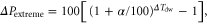
where ΔTdw is the change in dew point temperature. This change is derived for days with rain only since evidently this measures the moisture available to rain events better than the mean over dry as well as wet days.
The parameter α (in % per degree) is a scaling factor, which will be estimated from the available evidence from the model simulations and the observations. For α is 7% per degree the change in precipitation extremes is equal to the increase in near surface moisture, which we call CC scaling. However, we note that other factors, for instance related to dynamics of the atmosphere on different scales, may cause deviations from CC scaling. This will be taken into account by assuming a different value of α. Our approach does not imply that moisture availability is the only determinant of changes in precipitation extremes. The approach, however, implies that these other factors also scale with the dew point temperature. It will be shown later that the change in dew point temperature is close to the global mean temperature change, and therefore this assumption is in practice equivalent to the assumption that these factors scale with the global temperature.
The primary statistic for the precipitation extremes that will be determined here is the change in 99th percentile conditioned on wet events, ΔP99w (precipitation threshold 0.1 mm, wet hours for the hourly statistics and wet days for the daily statistics). This is the same quantity that has been computed for the previous set of scenarios issued in 2007 (Lenderink et al 2007), and this statistic is used in a time series transformation that further post processes climate data to user needs (Van den Hurk et al 2014). Admittedly, this is only one of the possible indices of the change in precipitation extremes and it is very worthwhile to look a different characteristics of extreme precipitation change (Zolina et al 2009, Leander et al 2014). The influence of changes in the number of wet-events on the occurrence of extreme events is accounted for separately, and is discussed in Lenderink et al (2014).
4. Evidence from observations and models
4.1. Observations
Here, we summarize results on observed relations between precipitation extremes and temperature and humidity that have been published earlier. A recent review paper on these relations, and their interpretation in a climate change context, has been just published by Westra et al (2014). Detailed results for the NL are given in Lenderink and van Meijgaard (2010) and Lenderink et al (2011).
Observations of hourly precipitation at De Bilt in the NL since 1906 reveal that the long term trends of P99w can be explained very well with changes in dew point temperature (Lenderink et al 2011). In figure 1 we show a reproduction of these results, yet with the observations extended over last 4 years until October 2014. Results are based on a moving 15-year window, and the average anomalies in P99w (from the mean over the whole time series) are plotted for the summer halve year (May until October) and the full year (January until December). In particular for the summer halve year, variations on decadal and longer time scales in dew point temperature derived from days with heavy rain, ΔTd*, match strikingly well with those in hourly precipitation extremes ΔP99w, with an inferred dependency of 10–14% per degree (Lenderink et al 2011). Over the century, the long term trend in ΔTd* matches with the mean dew point temperature trend, the latter being approximately equal to the mean temperature trend.

Figure 1. Variations in the 99th percentile of hourly precipitation conditioned on wet hours (P99w) in comparison to variations in dew point temperature. Anomalies are plotted against the mean over the whole period. Anomalies are first computed for each month separately, and then averaged over the months, May–October (left) and January–December (right). For dew point temperature the average dew point temperature (ΔTd) and the average dew point temperature on days with hourly precipitation exceeding the 90th percentile (ΔTd*) are plotted. Uncertainty bands provided for precipitation extremes are based on the 5–95th range computed from bootstrapping, resampling full years of data. Figure a is reproduction of figure 4(a) in Lenderink et al (2011), with 4 years more data (2010 until October 2014), and only for the P99w.
Download figure:
Standard image High-resolution imageTo explain such a strong relation between hourly precipitation extremes and dew point temperature at a climatic time scale, we look at variations on much smaller time scales. To this end hourly observations made at 27 stations in the NL for the last 20 years were analysed. Figure 2 shows the dependency of hourly precipitation extremes on dew point temperature derived by binning the data in fixed dew point temperature intervals (for details on the procedure see Lenderink and van Meijgaard 2010, Lenderink et al 2011). A clear dependency of hourly precipitation extremes on dew point temperature of approximately 14% per degree, two times the CC relation, is obtained. Data for summer (JJA) shows a 14% per degree dependency for the full range, whereas the data for winter (DJF) supports 7% per degree (see supplementary material). By considering 5 min precipitation, which is even more dominated by convective showers, a 2CC scaling was even found for the NL over an impressive 20° range in dew point temperature (Loriaux et al 2013).

Figure 2. Dependency of hourly precipitation extremes on dew point temperature derived from 27 stations in the Netherlands; left: observations, right: model output for a present-day climate simulation of RACMO2 for the same station locations. Dew point temperatures are taken 4 h before the event. Shown are results for the 90, 99 and 99.9th percentile of wet events. Solid line: raw data, stippled lines: estimated from a GPD fit, including uncertainty estimates (grey shading). Red and black linear lines show (exponential) dependencies of 7 and 14% per degree.
Download figure:
Standard image High-resolution imageThe cause and generality of the above 2CC scaling is open to debate. Here, we can only briefly discus the main issues and for an in depth discussion on observed scaling we refer to a recent review paper by Westra et al (2014). Analysis of hourly precipitation extremes for other mid-latitude regions often show a super CC scaling for intermediate temperature regimes, but also usually reveal lower dependencies or even a decrease in intensity at the highest temperature range (Mishra et al 2012). These studies, however, are generally based on temperature instead of dew point temperature, and are potentially affected by decreasing relative humidity for high temperatures, in which case a temperature increase does not necessarily imply a humidity increase (Hardwick Jones et al 2010, Lenderink and van Meijgaard 2010, Panthou et al 2014). Also dependencies in the frequency of precipitation type—for instance, large scale versus convective precipitation—on temperature have been shown to statistically influence the results (Haerter and Berg 2009). Recent research by tracking convective precipitation cells, however, reveals that super CC scaling is indeed a property of convective precipitation (Berg et al 2013, Moseley et al 2013). A scaling beyond the CC relation is commonly understood as a manifestation of a positive feedback from cloud dynamics due to latent heat release causing updrafts in a convective cloud to invigorate with warming (Loriaux et al 2013, Westra et al 2014).
For daily precipitation extremes a dependency close to the CC relation is found for the NL (Loriaux et al 2013). Yet, this result appears not very robust. At daily time scales both large scale and convective precipitation could lead to extreme events, and the interplay between the statistics of both type of precipitation is likely to affect the results. Therefore, we judge the CC scaling on a daily timescale to be less reliable than the 2CC scaling on (sub)hourly timescales.
4.2. Results from RACMO
Fields of changes in the P99w of daily and hourly precipitation, hereafter shortly 'the extremes', averaged over the ensemble of sixteen RACMO2 climate integrations are shown in figure 3. Changes in the hourly extremes are derived from the time series of daily maximum of hourly precipitation, which have been stored from the simulations. Results are shown for winter and summer season in 2071–2100 compared to the reference period 1981–2010. The global temperature rise between future and reference period is approximately 3.3 °C. We first show the results averaged over all ensemble members, so that we concentrate on the signal forced by greenhouse gas emissions (Fischer et al 2014).

Figure 3. Change in the 99th percentile of (a), (b) daily precipitation (precip) and (c), (d) the daily maximum of hourly precipitation (precmax) conditioned on wet-days. Shown is the relative difference between the future period 2071–2100 compared to the control periods 1981–2010 in % (left: winter, right: summer).
Download figure:
Standard image High-resolution imageIn winter changes in daily and hourly extremes are approximately equal, with typical values between +15 and +20%. In summer, the increase in daily extremes is lower, but the increase in hourly extremes is higher.
In winter, the pattern of the change in precipitation extremes largely resembles the change of winter mean precipitation (supplementary material). This finding can be interpreted as a mean shift in the intensity of all events, while the number of events does not change considerably. This is corroborated by the result that changes for the different percentiles of the distribution are very similar (supplementary material). The results are different in summer. The pattern of the mean change differs from the pattern of the change in the extreme and the results for the extremes depend on the index chosen, although less so for the percentiles based on wet days only (see supplementary material). While large parts of western Europe (W-EUR) experience a decrease in summer precipitation, there is a robust increase in precipitation extremes (Christensen and Christensen 2002, Vautard et al 2014). There is also support from observed trends that changes in summer and winter extremes could be different (Zolina et al 2008).
Changes in precipitation extremes are normalized by the local change in dew point temperature on days with rain, ΔTdw. Figure 4 shows that the pattern of these normalized changes are reasonably similar when derived from the 2071–2100 period (compared to reference) and the 2041–2070 period, with obviously more spatial noise for the earlier period due to the weaker climate change signal. Figure 4 shows only the results for hourly precipitation in summer, but results for winter and daily precipitation also show comparable patterns of changes derived from the two future periods (supplementary material). This similarity gives us confidence that our scaling framework is a reasonable approximation.

Figure 4. Changes in daily maximum of hourly precipitation in summer per degree rise in local dew point temperature (derived for days with rain). Changes (in % per degree) are derived comparing 2041–2070 (a) and 2071–2100 (b) to the reference period 1981–2010 from the 16 member ensemble of simulations. DT gives the dew point temperature change averaged over the shown W-EUR box. The lower two panels, (c), (d), give the same results, but now derived from only one member of the ensemble (member 1).
Download figure:
Standard image High-resolution imageIndividual members of the ensemble display large fluctuations in the change in extremes, typically of order 10–20% which is comparable to the mean change signal (supplementary material). Also, normalizing the change from a single member by the dew point temperature change (lower panels of figure 4) does not give a robust answer, and mainly reflects the natural variations of the climate system (Deser et al 2010, Rowell 2011, Fischer et al 2014). Therefore, the greenhouse gas forced change signal in precipitation extremes cannot be derived reliably from single simulations.
Area averaged over a box in W-EUR and over the NL, we find that in winter changes in hourly and daily precipitation extremes are between 5 and 7% per degree, which is slightly below CC scaling (figure 5). A scaling of a few percent below the CC relation can be understood from changes in the atmospheric moist adiabatic lapse rate with warming (O'Gorman and Schneider 2009). For summer, daily precipitation extremes increase at a lower rate of 3–5% per degree. However, the hourly extremes appear to follow a dependency close to CC scaling.

Figure 5. Average change P99w for daily precipitation (precip) and daily max of hourly precipitation (precmax) for the Netherlands and a box over Western Europe (see box in figure 3) per degree rise in dew point temperature. Upper 2 panels show results for winter and lower two panels for summer. The shaded band is the 10–90th range of P99w, derived from the deviations of the 16 ensemble members from the mean response. The two brown lines show an exponential dependency of 3 and 7% per degree.
Download figure:
Standard image High-resolution imageTo investigate how well RACMO2 represent hourly precipitation extremes, we investigate the scaling relations as discussed in the previous section. RACMO2 represent the observed dependency of hourly precipitation extremes reasonably well for intermediate dew point temperatures (see figure 2). The modeled intensity is approximately 50% of the observed one, but this is at least partly due to the scale mismatch with the model representing an area average of ∼140 km2 as compared to the station observations. The super CC behavior of the observations is rather well captured by the model for dew point temperature below 18 °C. However, for higher temperatures the model shows a rather strong decline in precipitation intensity, whereas the observations still reveal an increase. This could imply that RACMO2 underestimates the changes in hourly precipitation extremes in warm summer conditions. Similar behavior was found in another regional climate model that uses a different convective parameterization (Lenderink and van Meijgaard 2010).
Besides considering the modelled precipitation directly, indices derived from the atmospheric profiles of temperature, humidity and wind can also provide information on the severity of convective activity. A measure which is often used in climate change studies is the convective available potential energy (CAPE) (see e.g. Brooks et al 2003, Trapp et al 2007). The square root of CAPE is a measure of the strength of the upward motions in a convective cloud. CAPE has been computed from hourly model output saved at seven locations in the NL. Both in winter and summer substantial increases in CAPE are obtained, showing the potential for enhanced vertical motions in the atmosphere under convective conditions (see supplementary material). The increase in CAPE of approximately 10–15% per degree is consistent with the dependency of CAPE to perturbations consisting of a vertical uniform warming and unchanged relative humidity (Loriaux et al 2013). We think that the observed super CC scaling of hourly precipitation extremes is related to this enhancement of vertical motions (Trenberth et al 2003, Lenderink and van Meijgaard 2009)—a view recently supported by results from a simple conceptual model (Loriaux et al 2013) and a mesoscale model (Singleton and Toumi 2013). Thus, the increase in CAPE derived from the RACMO2 simulations supports potential increases in the intensity of showers beyond CC scaling.
4.3. Results from Harmonie
Twelve cases with extreme precipitation have been run with Harmonie under present-day and warmer (colder) climate conditions (see section 2.2). An analysis of changes in hourly precipitation extremes derived from these runs (except for one case) is described in Attema et al (2014) and here we only summarize their findings. An average increase in hourly extremes of 9–14% per degree dew point temperature rise was found, with the most extreme events converging towards the upper end of this range. However, the differences between the cases were also considerable, with about one quarter of the sensitivity experiments showing a response below 7% per degree, and one fifth a sensitivity above 14% per degree.
Here, we analyze the changes in daily extremes from these simulations. We start with analyzing the 12th case based on an event with a series of showers lasting almost 24 h, and which led to severe flooding in the NL (see supplementary material).
Two-day accumulated precipitation from the reference simulation, most of which fell within 24 h, and the three sensitivity experiments, are shown in figure 6. The 'plus 2' and the 'climate' perturbation both have an increase of near surface dew point of 2 °C, whereas the 'minus 2' perturbation has a decrease of 2 °C. Both warming experiments reveal an increase in precipitation amounts of +30% with respect to the reference, with maximum precipitation amounts increasing to 160–180 mm.

Figure 6. Two day precipitation sum (mm) for 26/27th August 2010 as simulated by HARMONIE. (a): precipitation sum from the control simulation, reflecting present-day climate conditions, (b) (c) simulation with a 2° warmer (colder) atmosphere compared to the reference simulation assuming unchanged relative humidity, and (d) future simulation using a perturbation in temperature and relative humidity derived from a climate model simulation under 2° global warming.
Download figure:
Standard image High-resolution imageTwo-day precipitation amounts from every grid box of the Harmonie domain are ranked, and plotted as a function of the probability of exceedance. For instance, a probability of exceedance of 0.001 corresponds to the precipitation amount exceeded in 0.1% of the domain (approx. 800 km2). Obviously, this is a strongly conditional probability, which should not interpreted directly as a climate probability. The outcome is plotted in figure 7, showing in general changes much larger than CC scaling averaging between 12 and 14% per degree.

Figure 7. Distribution of 2-day precipitation sum for 26/27th August 2010 under present-day climate conditions (black), as well as warmer (red and pink) and colder (blue) climate conditions derived from Harmonie results. For guidance the grey band (and brown lines) represent changes (with respect to the reference) according to 7% (and 12%) per degree.
Download figure:
Standard image High-resolution imageTo investigate the representativeness of the above results we show the combined daily precipitation statistics from the 11 cases in Attema et al (2014), with addition of the first-day of the above event, in figure 8. The probability of exceedance is now derived from data of all grid points of all 12 cases pooled together. For the far majority of the extremes, up to a probability of exceedance of 10−5, the dependency is close to 12% per degree. For the most extreme events with a probability of exceedance less than 10−5 the dependency to a temperature increase appears lower, yet we note that this tail of the distribution only consists of 15 data points. Also for the less extreme events (probability of 0.01) the climate perturbation gives a dependency closer to 7% per degree. Summarizing, the results with Harmonie for these 12 cases support an increase of 7–12% per degree in local daily precipitation amounts, with most of the extremes supporting the higher end of this range.

Figure 8. As figure 7 but now for the pooled data of daily precipitation for 12 events with extreme precipitation simulated by Harmonie (see text for details).
Download figure:
Standard image High-resolution image4.4. Synthesis of the evidence
All three sources of information have their merits, but also their limitations. Observations do not rely on model assumptions, but are difficult to interpret and to extrapolate into the future. The regional climate simulations are very long and therefore allow us to investigating very rare extreme events. They also incorporate changes in many aspects of the climate system, like for instance large scale circulation changes, and therefore allows us to evaluate whether a scaling on dew point temperature is appropriate. However, the representation of the mesoscale processes in these type of models is questionable, and there is a considerable scale mismatch between the 12 km grid of the model and the local information that is needed. The mesoscale model, Harmonie, represents mesoscale processes much better, and has a higher resolution of 2.5 km. Simulations with Harmonie can give us an answer to the question what would be the response of a convective shower to relatively simple perturbations (anticipated with global warming) of the atmosphere. Obviously, whether this answer is representative for the climate change signal needs further investigation, preferably with much longer simulations with a mesoscale model.
Based on the results provided above, we estimated a plausible range in the dew point temperature dependency of precipitation extremes, α (table 1).Values of α are different between daily and hourly precipitation extremes, and the different seasons. Given the uncertainty in precipitation processes at the mesoscale (Westra et al 2014) we generally use rather large uncertainty ranges for α.
Table 1. Scaling constants used for daily and hourly precipitation extremes (P99w) in % per degree dew point for summer and winter (first column), in comparison with results from RACMO, Harmonie, and observations. The last column provides additional information, provided when the α range does not correspond to the range given by RACMO2 and Harmonie (indicated by bold, italic numbers in second column).
| Scenario range α (% °C−1) | RACMO2 (% °C−1) | Harmonie (% °C−1) | Obs. (% °C−1) | Additional information/expert judgment | |
|---|---|---|---|---|---|
| DJF daily | 4–8 | 5–7 | — | ∼7 | Possible influence North Sea, increases in CAPE |
| DJF hourly | 5–9 | 5–7 | — | ∼7 | increases in CAPE |
| JJA daily | 2–12 | 3–5 | 7–12 | ∼7 | |
| JJA hourly | 7–14 | 6–8 | 7–14 | 10–14 | RACMO2 limitations |
For daily extremes in winter the RACMO2 results in figure 5 suggest 5–7% per degree. A slightly larger range of 4–8% per degree is chosen mainly to rely for the fact that the results are based on one modeling system. Preliminary results with Harmonie showed relatively large increases beyond CC scaling for a winter case , possibly influenced by warming of the North Sea (Lenderink et al 2008, Attema and Lenderink 2013). We also note the substantial increases in CAPE promoting the occurrence of showers. For the same reason, the upper value of α for changes in hourly extremes is set to 9% per degree; the lower estimate follows the average RACMO2 prediction of 5% per degree.
In summer daily precipitation extremes are assumed to change according to 2 and 12% per degree. The lower value is primarily based on RACMO2 results, giving approximately 3–5% per degree. We adjusted the lower boundary to 2% because these results are based on one model system only. The upper boundary is motivated by the Harmonie results. Changes in hourly extremes are between 7% and 14% per degree. The upper value is based on the observed relations with additional support from Harmonie. The lower value is close to the RACMO2 results.
For both seasons, hourly precipitation extremes increase faster than daily extremes, with a difference in the upper estimate of 1–2% per degree. This is consistent with the conclusion in Westra et al (2014) that short duration precipitation extremes may increase stronger than daily extremes.
5. Scenario construction
The scenarios of local precipitation extremes are part of a general set of four climate scenarios for the NL released in spring 2014. The main framework and method of these scenarios is described in Lenderink et al (2014). Scenarios are produced using the global mean temperature rise as primary steering variable. Values of global temperature rise that are considered are 1°, 1.5°, 2° and 3°, corresponding to the periods 2016–2045, 2031–2060, 2046–2075, and 2066–2095 in the RACMO2 simulations, respectively. In the general set of climate scenarios the RACMO2 results of these periods are resampled in order to optimize the spread between the four scenarios compared to the spread contained in the global climate model simulation performed in CMIP5 (Taylor et al 2012). The changes in a large range of variables and statistics are then derived from the resampled model output. For local precipitation extremes we do not directly use the modeled precipitation extremes, but employ the scaling framework as introduced in section 3. As the resampling hardly affect the results present here, we only show here the results obtained for the un-resampled model data.
First, we elaborate on relation between global temperature rise, local temperature, and dew point temperature. Figure 9 shows the maps of changes between 2071–2100 and 1981–2010 in local temperature, dew point temperature, and dew point temperature on days with 1 mm or more precipitation. In winter, changes in temperature are almost equal to the change in dew point temperature, which is a reflection of marginal changes in relative humidity. For eastern Europe the change in dew point on wet days is somewhat smaller, which is because wet (dry) days are on average relatively warm (cold) and the temperature response for those days is relatively small (large). In summer, there is a big difference between the temperature response and the dew point temperature response in southern Europe, with the temperature increase exceeding the global mean temperature change, whereas the dew point increase is smaller. This relates to a substantial decrease in relative humidity. The dew point temperature change on wet days, however, is surprisingly constant across the domain, slightly lagging the global temperature increase. The results are almost independent of the threshold for a wet day (supplementary material).

Figure 9. Changes in temperature (t2m), dew point temperature (td2m), dew point temperature on days with >1 mm (Pgt1) derived from RACMO2, 2071–2100 compared to 1981–2010. The color coding has been chosen such that 'white' means a change close to the rise in global mean temperature of 3.3 °C.
Download figure:
Standard image High-resolution imageFigure 10 shows the temperature and dew point temperature change as a function of the global mean temperature for two areas, NL and W-EUR. The same features as discussed above are obtained. Clearly, all variables relate almost linearly to the global mean temperature increase.

Figure 10. Mean dew point temperature rise, dew point temperature on days with rain (>1 mm day−1) and mean temperature rise as a function of global temperature rise. Results are ensemble means of 16 simulations with RACMO2.
Download figure:
Standard image High-resolution imageScenarios are now produced by computing the change in dew point temperature on wet days for the selected time periods, and using estimates of the scaling constants in table 1. In contrast to the previous, the dew point temperature change is based on the first eight members, which is done to maintain consistency with the main set of scenarios which are also based on the first eight members (Lenderink et al 2014).
For each of the future time periods, 2016–2045, 2031–2060, 2046–2075, and 2066–2095, we computed the change in dew point temperature on wet days with respect to the reference period, 1981–2010 for the NL. Figure 11 shows the resulting changes in daily precipitation extremes derived from scaling in comparison with the RACMO2 results. RACMO2 results are always within the range—the grey band—provided by the scaling. For the later period, RACMO2 results are generally at the lower range; for the early periods results are closer to the middle of the range.

Figure 11. Scenarios of ΔP99w of daily (shaded) and hourly (two magenta lines) precipitation extremes derived from scaling. The direct model results for daily extremes obtained with RACMO2 are shown the central blue dashed line, with the two outer dashed lines the mean response plus/minus the standard deviation between the 8 model runs. Results are percentage changes with respect to the reference period 1981–2010.
Download figure:
Standard image High-resolution image
With these scenarios we only aim to represent the climate change signal forced by changes in greenhouse gas concentrations. As shown by the results of the individual ensemble members of the RACMO2 simulations the magnitude of natural variations is potentially large (see supplementary material). How large natural variability is compared to the signal is dependent on the spatial averaging and the length of the climate period. For longer time periods and larger spatial domains, the climate noise due to natural variability generally decreases, while the signal is largely unaffected. The signal-to-noise ratio therefore depends on the typical spatial and temporal scales that are relevant for the user.
Finally, despite that we estimated the ranges in the scaling parameter α as good as possible from the available information, we admit that our estimates of α remain subjective. Provided with the same information, another specialist could have chosen different values by 1–3% per degree. With 3° warming this gives rise to a difference in the estimate change of 3–12%. Although this is substantial, we also stress that estimating the climate change signal in precipitation extremes from relatively short integrations or single members of an ensemble, which is a common approach, could also lead to errors of at least the same order of magnitude due to the natural variability.
6. Summary
Scenarios of changes in precipitation extremes are constructed using a simple scaling framework. This framework takes the change in near surface absolute humidity as a basis, which is motivated by the common assertion that increases in precipitation extremes with global warming are due to more moisture. Results of the very large ensemble of RACMO2 simulations provide support for our scaling approach. Scaling constants (measuring the relation between precipitation extreme and dew point temperature) are based on expert judgment, weighting results of a very large ensemble of regional climate integrations with RACMO2, results of a mesoscale model Harmonie, and observations (see table 1). In all scenarios, precipitation extremes on both daily and hourly time scale increase. For summer it is estimated from the provided evidence that this increase follows a dependency of 2–12 per degree dew point for daily extremes and 7–14 per degree dew point for hourly extremes. From model simulations it is obtained that the increase in dew point is slightly below the global temperature rise.
For all scenarios changes in precipitation extremes are given by an upper and lower estimate, which is here primarily an expression of the lack of knowledge and modeling ability of the underlying physics of convective precipitation as noted in a recent review paper (Westra et al 2014). Observations as well as case studies with mesoscale models suggest that local precipitation extremes are more sensitive to warming than can be inferred from regional climate model output. Although the latter results are still rather preliminary, we judge that it is essential that they are represented in the scenarios. This cumulates in a large uncertainty range present in the scenarios, which, from a user point of view, may be difficult to cope with.
Acknowledgments
We would like to acknowledge financial support from Dutch project Knowledge for Climate (KfC) and the project EU FP7 project IMPACT2C, and the ERC project INTENSE. Camiel Severijns is acknowledged for performing the runs with EC-Earth, and Erik van Meijgaard for the RACMO2 simulations. We would like to thank the reviewers and the board member for their constructive comments.